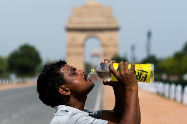
Max Temp Stays Above 45°C for Sixth Day: IMD Predicts Rain Soon!
Max Temp Stays Above 45°C for Sixth Day: IMD Predicts Rain Soon! For the sixth consecutive day, the maximum temperature has soared above 45°C, creating intense heat conditions. The Indian Meteorological Department (IMD) predicts a potential respite with rain over the weekend. This forecast brings hope to many who have been struggling with the relentless heatwave.
Max Temp Stays Above 45°C for Sixth Day: Brace for the Weekend!
At the National Data Centre, Ayanagar recorded 47°C on Friday, the second-highest maximum ever recorded there. The highest was 47.4°C on May 28, 1988. The last time Ayanagar recorded 47°C was on June 11, 2019, and May 24, 2013, before that.
IMD records also show that Ridge recorded a maximum of 46.4°C on Friday. The last time Ridge recorded this maximum was on May 24, 2013. This was the station's second-highest maximum, with the highest being 47.2°C on May 16, 2022.
With the month ending on Friday, May this year was the hottest since 2013, when the city's average maximum temperature was 41.5°C. On Friday, the maximum temperature rose slightly, marking the sixth consecutive day Safdarjung, Delhi's main weather station, recorded a high above 45°C, according to data from the India Meteorological Department (IMD).
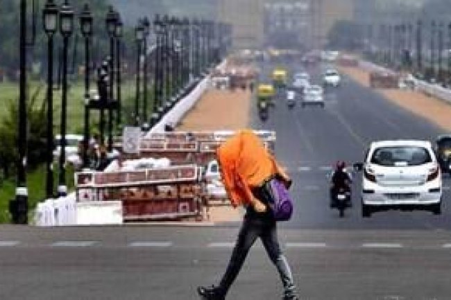
On Friday, the "real-feel" temperature or heat index in the Capital was 44°C. However, IMD predicted some relief with light to moderate rain expected over the weekend in parts of the city, which should slightly reduce the maximum temperature. A "yellow alert" was issued.
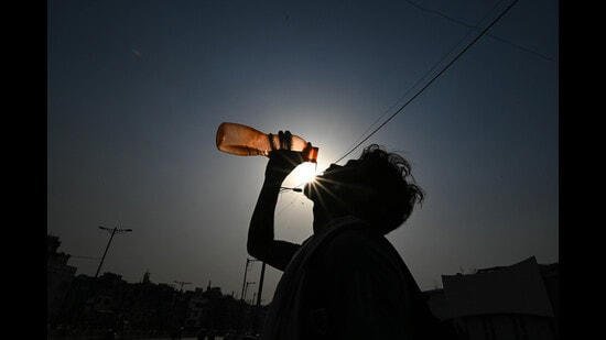
The maximum temperature on Friday was 45.8°C, six degrees above normal, and the minimum was 29°C, two degrees above normal. Over the last two weeks of May, Delhi's temperatures were unusually high, with Mungeshpur breaking the national record at 52.3°C on Wednesday. According to IMD, a maximum temperature 4.5°C or more above normal is considered a heatwave.
The maximum and minimum temperatures were 45.6°C and 30.4°C, respectively, a day earlier. This May was the hottest since 2013, with Delhi recording an average maximum of 41.4°C, which is 1.5°C above the long-period average (LPA) of 39.9°C.
"We expect generally cloudy skies on Saturday. Heatwave conditions might occur in isolated areas, with thunderstorms, dust storms, and drizzle possible," said Kuldeep Srivastava, an IMD scientist. "This is due to western disturbances. The thunderstorm may continue through Sunday and lower the temperature."
The maximum temperature is expected to drop to 42°C by Sunday and then gradually rise again, with the minimum oscillating between 29°C and 30°C over the next few days.
Meanwhile, Mungeshpur in Delhi's outskirts remained very hot, recording a high of 49.6°C, followed by 49.4°C at Narela and 49.2°C at Najafgarh. On Friday, the "real-feel" temperature in the Capital was 44°C, the same as the previous day. Another measure, the wet-bulb temperature, which indicates outdoor conditions, was close to 24.44°C. Once this measure exceeds 32°C, people face extreme health risks.
Other weather stations with moderate to severe heat waves included Palam (46.7°C - six degrees above normal), Ridge (46.4°C - seven degrees above normal), Ayanagar (47°C - six degrees above normal), and Lodhi Road (46.1°C - six degrees above normal). A severe heat wave is defined when the maximum temperature is more than 6.5°C above normal.
Delhi's air quality improved on Friday, with a 24-hour average AQI reading of 190 (moderate) at 4 pm, according to the Central Pollution Control Board's national bulletin. The AQI was 227 (poor) a day before. The Air Quality Early Warning System for Delhi forecasts that the air quality will remain in the "poor" category over the weekend.
What's Your Reaction?